|
|
Sterling Mountain (3715 feet) |
NOTES
This mountain is called both "Sterling Mountain" and "Whiteface Mountain" in different sources. The newer sources that I've seen tend to use the name "Sterling Mountain," and so I use that name here. I found an article about a proposed extension to the Smugglers' Notch ski area that says the ski area planners used the name "Whiteface Mountain." This made me wonder if that name was coined by the ski area and then stuck long after the expansion was cancelled. However, when I asked a question about the dualing names on Facebook's "Hiking in Vermont" group, I was pointed to this interesting article about the White Rocks Trail. The article contains a picture of a page from the 1917 edition of the Long Trail Guide showing the mountain labeled as "Whiteface." Clearly the "Whiteface" name predates the ski area!
Other members of the Facebook group pointed out that the mountain is the main peak of the Sterling Range, which was located in the now disincorporated town of Sterling, Vermont. However, it remains unclear to me just when the name "Sterling" was applied to the mountain and why that is the name that seems to be primary in modern sources.
As an aside, the White Rocks Trail, mentioned above (and not to be confused with a White Rocks Trail on Bald Mountain in southern Vermont), is a now defunct trail that once connected the summit of Sterling (Whiteface?) Mountain to the Beaver Meadow Trail. It went over an outcropping known as White Rocks from which a good view could be obtained. It was suggested on the Facebook group that perhaps that is where the name "Whiteface" originally came from. For many years, White Rocks was a popular hiking destination, but now the trail can only be partially followed; bushwacking skills are needed to visit White Rocks today. One of the Facebook group members noted, "the White Rocks outcropping was once a coveted hiking destination for the views, but they are nearly covered by continued sapling growth." Perhaps the trail fell into disuse as the view disappeared.
Today was a beautiful, crisp fall day. I got an early start, reaching the main (lower) parking area for the Beaver Meadow Trail by around 8:30am. The foliage was past its prime, but at the lower elevations there were still enough leaves on the trees to create a beautiful yellow-gold canopy over the trail. However, after only gaining 500 feet, or so, most of the trees were bare.
My hike started by continuing on foot up the now rough Beaver Meadow Road for about 0.6 miles until I reached the smaller upper parking area. From there the trail itself started. It was wide and easy, ascending gradually along an old road, perhaps a logging road. At about 2.4 miles from the lower parking area, the trail turned left to cross Beaver Meadow Brook. My original plan for the day was to climb Morse Mountain by going that way, however the stream crossing proved difficult, so I changed my plans. Instead, I continued down the logging road following the Beaver Meadow Cutoff trail for another 0.3 miles to the Whiteface Trail.
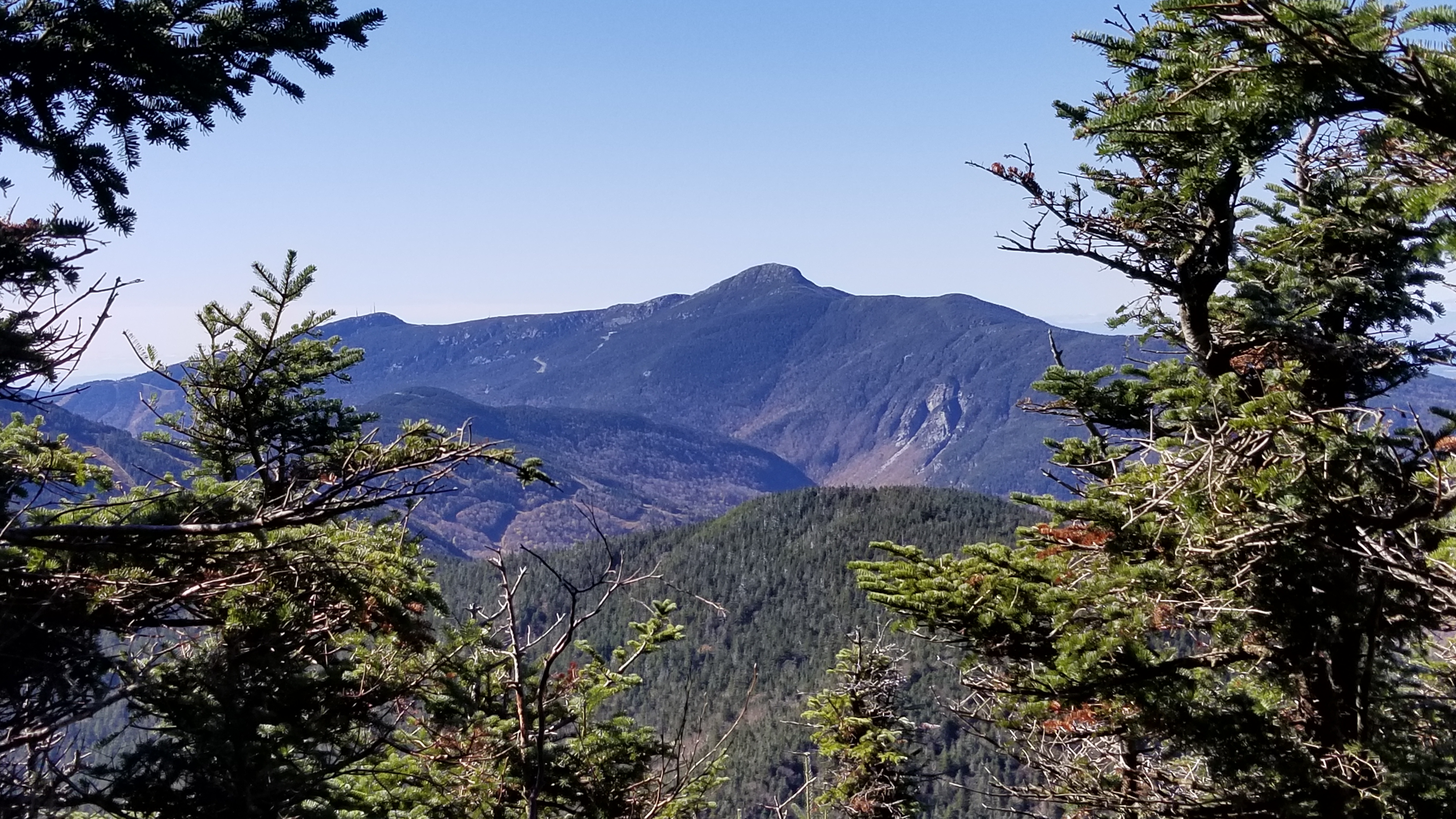
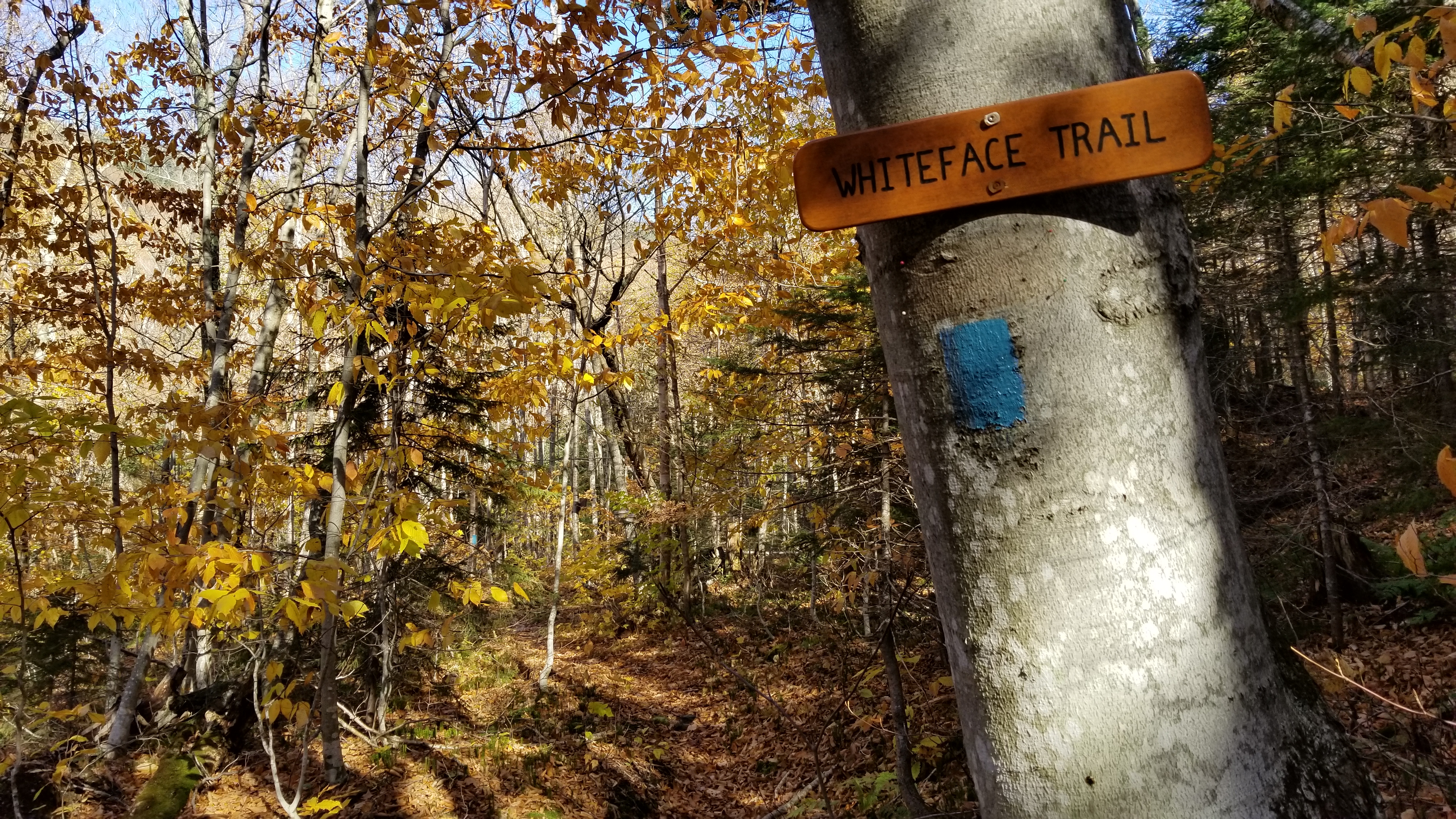
The Whiteface trail ascended steeply for 1.0 mile over much more rugged terrain. The trail was tricky to follow in places. Blazes were sparse, and the trail was obviously not heavily traveled. That, together with the freshly fallen leaves, particularly at lower elevations, made it necessary to stay alert. The Whiteface trail ended at Whiteface Shelter on the Long Trail. From there I followed the Long Trail north another 0.5 miles, over more steep and rugged terrain, to the summit. From the summit a beautiful view of Mansfield could be had (pictured at the top of this page), but the summit was otherwise fully forested.
Overall, the climb from the lower parking area to the summit was 4.2 miles with an elevation change of 2300 feet for an average grade of 547 ft/mile. However, this average hides the fact that the Whiteface Trail and Long Trail together account for the bulk of the vertical ascent, with a grade closer to 1000 ft/mile for those sections.
Return to the Vermont 100 highest list.